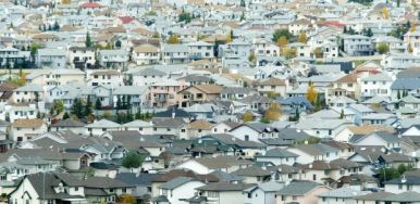
Calgary’s urban sprawl and the rapid growth of Alberta’s oilsands can be seen from space, research from the University of Calgary has revealed.
University of Calgary researchers compiled thousands of satellite images taken of Alberta over a decade and analyzed the changes in vegetation over time. The result is a map that illustrates the impact of human activity from 2001 to 2011 on a scale never been seen before, highlighting the reach of urban growth, oilsands development, mining and clear-cutting.
“The (oilsands) mines have more than doubled in size over that 10 years, which is really no surprise if you’ve followed the oil industry, but the fact that you can see them from space on a map of the whole province is pretty significant,” said Greg McDermid, the project’s lead researcher.
According to the Canadian Association of Petroleum Producers, the industry has been trying to reduce its impact on the environment as demand continues to fuel expansions. Its data shows that the footprint of oilsands mines has ballooned by more than 25 per cent, or 171 square kilometres, in just the past four years, rising to 844 sq. km.
“The answer is not to just stop development,” said Geraldine Anderson, spokeswoman of the association, pointing to estimates that global requirements for energy will increase by 33 per cent by 2035, with fossil fuels expected to make up the majority.
The new map and other monitoring of oil production underscore the need to impose new rules that set limits on the pace of development and protect wildlife, such as declining populations of woodland caribou, said Simon Dyer, a regional director with the environmental think-tank Pembina Institute.
“What we’re seeing is still only the tip of the iceberg. In future years, we will look back on 2014 and say, this is when the oilsands had barely even started,” Dyer said.
The new Alberta map also throws into focus the extent of urban sprawl in Calgary and outlying communities. It shows tremendous expansions of housing and business development into natural lands in Calgary’s southeast, northeast and along the northern perimeter.
Airdrie’s growth was also large enough to be captured by satellite images, with massive swaths of development stretching into the south and a smaller but notable new footprint to the north.
Bev Sandalack, associate dean at the University of Calgary’s faculty of environmental design, said too many new Calgary neighbourhoods were spread out over large areas, straining city hall’s ability to pay for basic services, from public transit to recreation.
“It’s only by the city being able to impose some constraints on development and be pretty hard-nosed about the kind of density and urban form that they’ll allow, will this pattern (change),” said Sandalack, also lead researcher at the university’s Urban Lab, a think-tank on community planning and urban development.
Click here for the complete article by Reid Southwick in the Calgary Herald.
Image courtesy of Ted Rhodes, Calgary Herald.


